CAADiX

Geoinformatics and 3D Data Capture

Geoinformatics is an interdisciplinary field that processes geographic information (geodata) through the combination of computer science, geosciences, and surveying technology. It focuses on the acquisition, storage, analysis, and visualization of geographic data. The goal is to solve spatial problems by processing and visualizing data with a geographical component. Applications of geoinformatics can be found in areas such as cadastral surveying, asset & infrastructure surveying, monitoring & construction surveying, and building & urban planning.

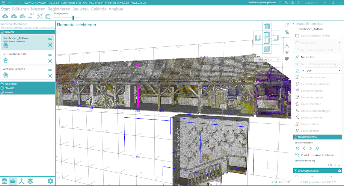
3D data capture refers to the technologies and processes used to collect three‑dimensional information about objects or environments. Various technologies can be used, such as:

Laser Scanning:
A laser beam scans a surface and measures distances to create a point cloud of 3D coordinates.

Photogrammetry:
Images are taken from different angles, and software calculates the 3D geometry of an object or landscape.

LIDAR (Light Detection and Ranging):
Similar to laser scanning, often performed from aircraft or drones to capture large‑area 3D data.

Using the technologies listed above and the resulting point clouds, you can generate sections, 2D/3D plans, and BIM models.
Infrastructure Management / Information Systems

  • rmDATA Smart Infra – A software solution specifically developed for managing municipal infrastructure such as water and wastewater networks, lighting, cemeteries, natural assets, empty conduits, trees, or traffic signs.
    https://www.rmdatagroup.com/produkte/rmdata-smart-infra/
     
  • rmDATA GeoDesktop – A GIS tool used for managing and visualizing geospatial data, for example in property management, infrastructure and lease management, land acquisition, and telecommunications.
    https://www.rmdatagroup.com/produkte/rmdatageodesktop/
     
  • GeoWeb
    GeoWeb is a powerful GIS solution for visualizing, editing, and analyzing geospatial data directly in a web browser. It enables the easy integration, management, and distribution of spatial information over the internet.
    https://www.rmdatagroup.com/produkte/rmdatageoweb/
     
  • rmDATA Inventory Manager: The rmDATA Inventory Manager is a software solution for the efficient management of infrastructure and asset data. It supports the collection, maintenance, and analysis of inventory data, especially in technical infrastructure and administration.
     
  • Smart Networx is a tool for managing and analyzing networks, particularly in the field of utility infrastructure. It supports planners and operators in efficiently modeling and analyzing networks.
    https://www.rmdatagroup.com/produkte/rmdata-smart-networx/
     
  • Smart Area is a solution for planning and managing land areas. The software optimizes the use and management of plots and surfaces by capturing and visualizing spatial data.
    https://www.rmdatagroup.com/produkte/rmdata-smart-area/